This site is intended to provide you with information on Land Surveying in the Tupelo, MS and Lee County area of Mississippi. If you’re looking for a Tupelo Land Surveyor, you’ve come to the right place. If you’d rather talk to someone about your land surveying needs, please call our local number at (662) 346-2096 today. For more information, please continue to read.
Land Surveyors are professionals who make precise measurements to determine the size and boundaries of a piece of real estate. While this is a simplistic definition, boundary surveying is one of the most common types of surveying related to home and land owners. If you fall into the following categories, please click on the appropriate link for more information on that subject:
Tupelo Land Surveying services:
I need to know where my property corners or property lines are. (Boundary Survey)
I have a loan closing or re-finance coming up on my home in a subdivision. (Lot Survey)
I need a map of my property with contour lines to show elevation differences for my architect or engineer. (Topo Survey)
I’ve just been told I’m in a flood zone or I’ve been told I need an elevation certificate in order to obtain flood insurance or prove I don’t need it. (Flood Survey)
I’m purchasing a lot/house in a recorded subdivision. (Lot Survey – See Boundary Survey if you’re not in a subdivision.)
I’m purchasing a larger tract of land, acreage, that hasn’t been subdivided in the past. (Boundary Survey)
Contact Tupelo Land Surveying services TODAY at (662) 346-2096.
When a road gets busier, businesses show up. It happens every time. A new highway opens, traffic picks up, and suddenly empty land along that road starts looking valuable. Retailers want in. Warehouses need the truck access. Hotels want visibility. Construction surveys help make sure all those projects get built right, even when several of them are going up at the same time in the same area.
Why Businesses Tend to Follow Traffic Patterns Long Before Buildings Appear
Businesses go where the customers are, and customers go where the roads take them. That’s why a corridor can attract serious commercial interest years before it’s even fully built. Retailers start scouting corners. Industrial tenants look for easy highway access. Service businesses want spots where drivers can see them and pull in easily.
Each of those projects needs accurate positioning before work starts. The road next to them might still be changing, neighboring sites might be under construction at the same time, and getting the layout wrong from the start causes problems that don’t go away. Construction surveys give each project a solid, accurate base to build from before the first shovel hits the ground.
How Construction Surveys Help Separate Multiple Commercial Projects Sharing the Same Corridor
Picture a gas station, a fast food spot, a small hotel, and a warehouse all going up within a few hundred feet of each other. Each has its own builder and its own plans, but they’re all sharing the same road frontage. When that happens, where one project sits directly affects the ones next to it.
A building placed too far forward blocks the sight lines of the business beside it. A driveway in the wrong spot creates conflict with the next entrance over. Construction surveys tie each project to the same reference points, so every site gets built in the right place without accidentally making things harder for the projects right next door.
Why Entrance Locations and Turning Movements Influence Commercial Site Planning
Getting in and out of a site has to work smoothly, or the whole place becomes a headache. A badly placed restaurant entrance backs up traffic on the main road at lunch. A warehouse with a tight truck turn slows down deliveries every single day. A retail entrance too close to a busy intersection frustrates customers before they even get to the parking lot.
The entrance has to work first, and everything else gets planned around it. Buildings, parking, and delivery areas all follow the access point. Construction surveys place driveways and entry cuts accurately from the start, so the site works the way it was designed to, for drivers, for delivery trucks, and for everyone coming and going every day.
How Construction Surveys Help Commercial Areas Evolve Without Losing Organization
A corridor rarely fills in all at once. One project goes up, then another, then a few more over the next several years. Each new business takes a piece of the remaining land until the whole stretch is developed. That slow build-up can get messy without accurate survey work keeping things in order.
Here’s what construction surveys do as more businesses move into a growing corridor:
Each new project ties to the same reference points as the ones before it, so the whole corridor stays spatially consistent
Shared access between neighboring sites gets laid out correctly early, cutting down on conflicts as traffic grows
Building setbacks stay consistent across properties, making the strip easier and safer to drive through
Later projects connect back to earlier ones accurately, even when years separate them
Without that consistency, a corridor ends up feeling like a random collection of buildings instead of an organized commercial area.
Why Emerging Transportation Corridors Often Create New Economic Centers
Busy roads pull commercial activity away from older town centers over time. It’s not dramatic, it happens gradually, but the results are real. New strips of retail, warehouses, and mixed-use development appear along expanding roads while older downtown areas see less traffic than they used to.
Construction surveys are part of what turns a busy road into a functional commercial area. Each project built accurately, with the right positioning and proper access, adds something useful to the corridor. Over time, those individual projects come together and form a real economic center, one that serves the whole surrounding area in ways the older commercial zones simply can’t reach anymore.
Frequently Asked Questions
What is a construction survey?
It gives builders the layout and positioning information they need to place buildings, driveways, and site features accurately during construction.
Why are construction surveys important for commercial growth?
They keep projects accurate and organized as development spreads along busy roads, making sure each new site fits in with what’s already there.
Who typically uses construction survey services?
Developers, contractors, engineers, builders, and commercial property owners all use them throughout the building process.
Can construction surveys help projects near highways and major roads?
Yes, they support accurate placement of buildings, entrances, and site features that depend on how traffic moves along the road.
Do construction surveys only benefit individual projects?
No, they also keep things consistent across a whole corridor as more businesses develop along the same route over time.
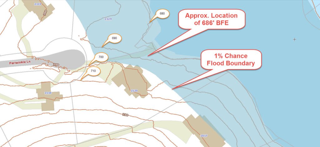
FEMA’s Flood Insurance Rate Maps (FIRMs) or just Flood Maps are provided after a flood risk assessment has been completed or updated for a community. This study is known as a Flood Insurance Study. The FIRM gives you the Base Flood Elevations (BFEs) and insurance risk zones in addition to floodplain boundaries. The FIRM may also show a delineation of the regulatory floodway.
Once the “insurance risk zone” (commonly referred to as the flood zone) is determined, actuarial rates, based on these risk zones, are then applied for newly constructed, substantially approved, and substantially damaged buildings. FEMA uses these rates to determine the insurance rate you will pay for flood insurance
FEMA’s Digital Flood Maps
FEMA discontinued the production and distribution of paper flood maps in 2009 as part of its Digital Vision Initiative. This affected all the Flood Maps, boundary information, and study reports. However, clients can still view the products for free through their website or buy them in digital format.
To view these flood maps online, go to FEMA’s Map Service Center and key in your address (hi-lited area shown here) search for your home. This will prompt you to then select the map that covers your area. The Flood Maps are somewhat cumbersome to use online. It is best to go through the tutorial on the bottom right of the address search page for an easier and more effective use of the GIS map.
 Land Surveyors are professionals who make precise measurements to determine the size and boundaries of a piece of real estate. While this is a simplistic definition, boundary surveying is one of the most common types of surveying related to home and land owners. If you fall into the following categories, please click on the appropriate link for more information on that subject: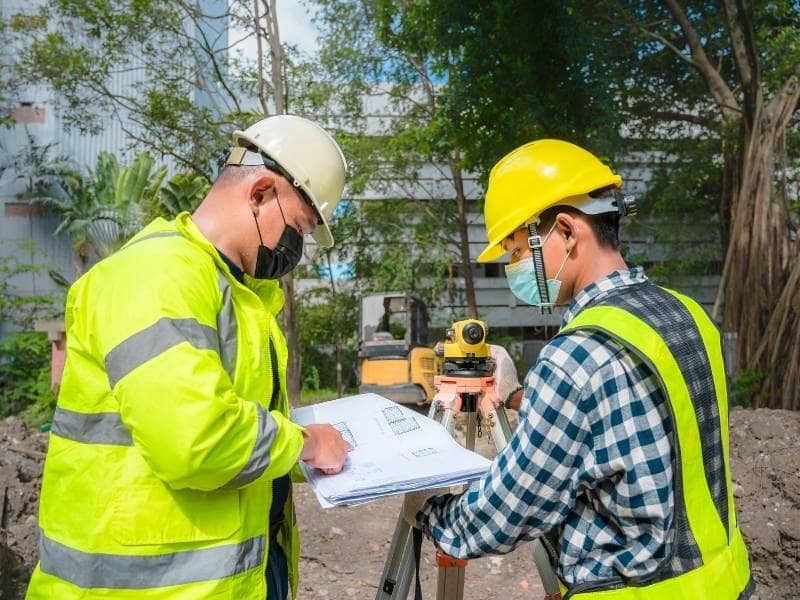
 FEMA’s